
Khmelnytskyi Oblast
Khmelnytskyi Oblast
Хмельницька область | |
|---|---|
| Khmelnytska oblast[1] | |
 Flag  Coat of arms | |
| Nickname: Хмельниччина (Khmelnychchyna) | |
 | |
| Coordinates: 49°32′N 26°52′E / 49.53°N 26.87°E | |
| Country | |
| Established | 22 September 1937 |
| Administrative center | Khmelnytskyi |
| Government | |
| • Governor | Serhii Tiurin[2] |
| • Oblast council | 84 seats |
| • Chairperson | Violeta Labazyuk[3] |
| Area | |
• Total | 20,645 km2 (7,971 sq mi) |
| • Rank | Ranked 19th |
| Population (2022)[4] | |
• Total | |
| • Rank | Ranked 14th |
| GDP | |
| • Total | ₴ 120 billion (€3.1 billion) |
| • Per capita | ₴ 96,964 (€2,500) |
| Time zone | UTC+2 (EET) |
| • Summer (DST) | UTC+3 (EEST) |
| Postal code | |
| Area code | +380-38 |
| ISO 3166 code | UA-68 |
| Vehicle registration | вх, нх |
| Raions | 3 |
| Cities (total) | 13 |
| • Regional cities | 4 |
| Urban-type settlements | 24 |
| Villages | 1416 |
| HDI (2022) | 0.722[6] high |
| FIPS 10-4 | UP09 |
| NUTS statistical regions of Ukraine | UA53 |
| Website | adm-km.gov.ua |
Khmelnytskyi Oblast (Ukrainian: Хмельницька область, romanized: Khmelnytska oblast), also known as Khmelnychchyna (Ukrainian: Хмельниччина), is an oblast (province) in western Ukraine covering portions of the historical regions of western Podolia and southern Volhynia. The administrative center of the oblast is the city of Khmelnytskyi. The current estimated population is around 1,228,829 (2022 estimate).[4]
Created in 1937 out of border okrugs of Vinnytsia Oblast, in 1941–44 it was under Nazi Germany occupation and part of the Reichskommissariat Ukraine (Wolhynien und Podolien general district). Following the Kamenets-Podolsky pocket in spring of 1944 as part of the Proskurov-Chernovtsy operation, Soviet troops removed the German occupation in the region. Until 4 February 1954 it was called Kamianets-Podilskyi Oblast (Ukrainian: Кам'янець-Подільська область, romanized: Kamianets-Podilska oblast) and was centered in Kamianets-Podilsky until 1941. The region rebranding took place after the official renaming of the region's administrative center to Khmelnytskyi.
Geography
[edit]Khmelnytskyi Oblast has a total area of 20,600 km2 (7,953.70 sq mi) (3.4% of the total area of Ukraine) and is located between 48°27' and 50°37' north latitude and between 26°09' and 27°56' east longitude. It is 220 km (136.70 mi) long when measured from north to south, and is 120 km (74.56 mi) in length when measured from east to west. It is associated with a historical region of Podolia, yet in reality its territory is split almost in half, the northern in Volhynia, and the southern in Podolia. Its Volhynian region contains smaller cities like Iziaslav, Starokostiantyniv, Shepetivka, while its Podolian portion more developed cities of Khmelnytskyi and Kamianets-Podilskyi.
The oblast borders the Rivne Oblast to the northwest, the Zhytomyr Oblast to the northeast, the Vinnytsia Oblast to the east, the Chernivtsi Oblast to the south, and the Ternopil Oblast to the west.
Elevations
[edit]The Podolian Upland (270–370 meters above sea-level) occupies the central area of the Khmelnytskyi Oblast. The northwestern areas of the oblast are part of the Volyn highland (highest point — 329 m above sea-level), while to the north, the oblast claims a part of the historic region of Polissia (highest point — 200–250 m above sea-level). The southwestern territory of the Khmelnytskyi Oblast is crossed by the Tovtry range (Ukrainian: Товтровий кряж, romanized: Tovtrovyi kriazh), which includes Mount Velyka Buhaikha (Ukrainian: Велика Бугаїха), the highest point of the oblast at 409 m above sea-level. The extreme south of the oblast has a surface with canyon-like river valleys. The Dniester Reservoir located there is the lowest point of the oblast (121 m above sea level).
Rivers and Lakes
[edit]There are 120 rivers with a length of 10 km (6.21 mi) or more in the Khmelnytskyi Oblast. The largest of these are the Dniester River (which flows for 160 km (99.42 mi) within the oblast), as well as its tributaries: Smotrych, Ushytsia, and the Zbruch — and the Southern Buh River (which flows for 120 km (74.56 mi) within the oblast), as well as its tributaries: Buzhok, Ikva, and Vovk. The rivers of the Dnieper River's basin — Horyn, Khmora, and Sluch Rivers also run through the oblast. The oblast's lakes are located mostly in basin of the Horyn River. The largest reservoir in the oblast is the Dniester Reservoir.
There are 1858 ponds and/or reservoirs in the oblast. The largest of these include Shchedrivske (with a surface area of 12.58 km2 (4.86 sq mi)), Novostavske (with a surface area of 11.68 km2 (4.51 sq mi)), and Kuzmynske (with a surface area of 7.65 km2 (2.95 sq mi)).
History
[edit]Historic administrative affiliation of the area:
- 1937–1941: USSR, Ukrainian SSR
- 1944–1991: USSR, Ukrainian SSR
- since 1991: Ukraine: Khmelnytskyi Oblast
Khmelnytskyi Oblast was created on September 22, 1937, as the Kamianets-Podilskyi Oblast (Ukrainian: Кам'янець-Подільськa область, romanized: Kamianets-Podilska oblast) out of border okruhas (Proskuriv and Kamianets-Podilskyi) of the Vinnytsia Oblast.
In March 1941 the administrative center of the oblast was moved from Kamianets-Podilskyi to the city of Proskuriv. During the World War II the territory was part of another administrative division (General District Wolhynien und Podolien, see Reichskommissariat Ukraine), but after liberation from the Nazi Germany, Khmelnytskyi Oblast was reinstated in its original borders. In 1954, Proskuriv was renamed Khmelnytskyi (in honour of Bohdan Khmelnytskyi), and soon afterward, the oblast was renamed to Khmelnytskyi Oblast (Ukrainian: Хмельницька область, romanized: Khmelnytska oblast).
Administrative divisions
[edit]The oblast is subdivided into 3 raions (administrative districts). It consists of 13 cities, 24 towns, and more than 1,417 villages.
The following data incorporates the number of each type of administrative divisions of Khmelnytskyi Oblast:
- Administrative Center – 1 (Khmelnytskyi);
- Raions — 3;
- Hromadas — 60.
The local administration of the oblast is controlled by the Khmelnytskyi Regional Council. The governor of the oblast is the Khmelnytskyi Regional Council speaker, appointed by the President of Ukraine.

Demographics
[edit]Khmelnytskyi Oblast's population is 1,401,140 as of January 1, 2004. As of 2002, the oblast ranks 13th by population in Ukraine. The population density is 69.5/km2.
Pensioners make up 453,800 thousand people or 31,7% of population. The birth rate per 1,000 residents is 8.3, and the death rate — per 1000 residents – 16.1.[7] The urban population, according to the 2001 Ukrainian Census data, accounted for 729,600 people, or 51%, and the rural population — for 701,200 people, or 49%.[8]
According to the data, the number of men accounted for 659,900 people, or 46.1%, that of women — 770,900 people, or 53.9%.
Language
[edit]
Due to the Russification of Ukraine during the Soviet era, the share of Ukrainian-speakers in the population of Khmelnytskyi Oblast gradually decreased between the 1970 and 1989 censuses, while the share of Russian-speakers increased.[9] Native language of the population of Khmelnytskyi Oblast according to the results of population censuses:[10][11][12][13][14][15]
| 1959 | 1970 | 1979 | 1989 | 2001 | |
|---|---|---|---|---|---|
| Ukrainian | 89.4% | 93.1% | 92.3% | 91.3% | 95.2% |
| Russian | 5.7% | 5.8% | 6.9% | 8.0% | 4.1% |
| Other | 4.9% | 1.1% | 0.8% | 0.7% | 0.7% |
Native language of the population of the raions and cities of Khmelnytskyi Oblast according to the 2001 Ukrainian census:[16]
| Ukrainian | Russian | |
|---|---|---|
| Khmelnytskyi Oblast | 95.2% | 4.1% |
| City of Khmelnytskyi | 88.4% | 10.4% |
| City of Kamianets-Podilskyi | 91.2% | 7.1% |
| City of Netishyn | 87.7% | 11.4% |
| City of Slavuta | 92.3% | 7.2% |
| City of Shepetivka | 93.5% | 5.7% |
| City of Starokostiantyniv | 92.0% | 7.5% |
| Bilohiria Raion | 99.0% | 0.8% |
| Vinkivtsi Raion | 97.2% | 2.6% |
| Volochysk Raion | 98.5% | 1.3% |
| Horodok Raion | 98.5% | 1.0% |
| Derazhnia Raion | 98.2% | 1.4% |
| Dunaivtsi Raion | 98.4% | 1.3% |
| Iziaslav Raion | 97.0% | 2.8% |
| Kamianets-Podilskyi Raion (in pre-2020 borders) |
98.6% | 1.2% |
| Krasyliv Raion | 98.4% | 1.4% |
| Letychiv Raion | 98.2% | 1.5% |
| Nova Ushytsia Raion | 96.5% | 3.3% |
| Polonne Raion | 98.4% | 1.4% |
| Slavuta Raion | 98.8% | 1.1% |
| Starokostiantyniv Raion | 98.6% | 1.1% |
| Stara Syniava Raion | 98.7% | 0.8% |
| Teofipol Raion | 98.9% | 0.8% |
| Khmelnytskyi Raion (in pre-2020 borders) |
95.8% | 2.0% |
| Chemerivtsi Raion | 99.1% | 0.8% |
| Shepetivka Raion (in pre-2020 borders) |
97.9% | 1.7% |
| Yarmolyntsi Raion | 98.1% | 1.5% |
Ukrainian is the only official language on the whole territory of Khmelnytskyi Oblast.[17]
According to a poll conducted by Rating from 16 November to 10 December 2018 as part of the project «Portraits of Regions», 85% of the residents of Khmelnytskyi Oblast believed that the Ukrainian language should be the only state language on the entire territory of Ukraine. 8% believed that Ukrainian should be the only state language, while Russian should be the second official language in some regions of the country. 3% believed that Russian should become the second state language of the country. 4% found it difficult to answer.[18]
On 15 June 2022, a moratorium on the public use of Russian-language cultural products was imposed in Khmelnytskyi Oblast by a decision of the Khmelnytskyi Oblast Council.[19]
In 2023, Khmelnytskyi Oblast Military Administration approved the «Programme of development and functioning of the Ukrainian language as the state language in all spheres of public life in Khmelnytskyi Oblast for 2023—2025», the main purpose of which is to strengthen the position of the Ukrainian language in various spheres of public life in the oblast.[20][21]
According to the research of the Content Analysis Centre, conducted from 15 August to 15 September 2024, the topic of which was the ratio of Ukrainian and Russian languages in the Ukrainian segment of social media, 88.8% of posts from Khmelnytskyi Oblast were written in Ukrainian (86.0% in 2023, 77.9% in 2022, 41.8% in 2020), while 11.2% were written in Russian (14.0% in 2023, 22.1% in 2022, 58.2% in 2020).[22][23]
After Ukraine declared independence in 1991, Khmelnytskyi Oblast, as well as Ukraine as a whole, experienced a gradual Ukrainization of the education system, which had been Russified[24] during the Soviet era. Dynamics of the ratio of the languages of instruction in general secondary education institutions in Khmelnytskyi Oblast:[25][26][27][28][29][30][31]
| Language of instruction, % of pupils |
1991— 1992 |
1992— 1993 |
1993— 1994 |
1994— 1995 |
1995— 1996 |
2000— 2001 |
2005— 2006 |
2007— 2008 |
2010— 2011 |
2012— 2013 |
2015— 2016 |
2018— 2019 |
2021— 2022 [32] |
2022— 2023 [33] |
| Ukrainian | 81.5% | 84.1% | 87.3% | 89.7% | 92.0% | 98.0% | 99.3% | 99.5% | 99.5% | 99.5% | 99.5% | 99.7% | 99.90% | 99.74% |
| Russian | 18.5% | 15.9% | 12.7% | 10.3% | 8.0% | 2.0% | 0.4% | 0.3% | 0.2% | 0.2% | 0.2% | 0.1% | — | — |
According to the State Statistics Service of Ukraine, in the 2023—2024 school year, of the 135,705 pupils in general secondary education in Khmelnytskyi Oblast, 135,475 (99.83%) were studying in classes where Ukrainian was the language of instruction, while 230 (0.17%) were studying in classes where Polish was the language of instruction.[34]
Age structure
[edit]- 0-14 years: 15.1%
 (male 101,597/female 95,783)
 - 15-64 years: 68.5%
 (male 435,464/female 463,058)
 - 65 years and over: 16.4% (male 69,479/female 145,420) (2013 official)
Median age
[edit]- total: 40.4 years
- male: 37.1 years
- female: 43.6 years
 (2013 official)
Economy
[edit]The economy of the oblast mostly deals with the energy industry, transport and agriculture. The oblast is situated at a historical crossroad of the railway and highway routes connecting Central Europe to Black Sea coast and Russia (with the city of Shepetivka being the most important railway junction). The Khmelnyts’ka nuclear power plant in the city of Netishyn is the most important industrial company of the oblast. Notable machinery, armament and chemical industries are also present.
Attractions
[edit]- Kamianets National Historical-Architectural Reserve (including the Old Town and the Castle)
- Medzhybizh National Historical-Cultural Reserve (including the Fortress)
- Samchyky National Historical-Cultural Reserve
Nomenclature
[edit]Most of Ukraine's oblasts are named after their administrative center cities, officially referred to as "oblast centers" (Ukrainian: обласний центр, translit. oblasnyi tsentr). The name of each oblast is a relative adjective, formed by adding a feminine suffix to the name of respective center city: Khmelnytskyi is the center of the Khmelnyts’ka oblast’.
Gallery
[edit]-
 Proskuriv kalancha
 -

-

-
 Independence Avenue in Netishyn
 -
 Church of Saint Dorothy in Slavuta
 -
 John the Baptist Church in Starokostiantyniv
 -
 Defense tower in Starokostiantyniv
 -
-
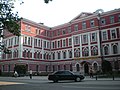
 Khmelnytskyi Oblast administration building
 -
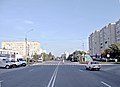
 Proskurivska street in Khmelnytskyi
 -
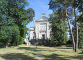
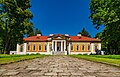 Chechels' Palace, a part of the Samchyky Estate
 -
 Medieval fortress in Letychiv
 -
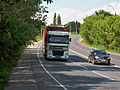 Highway H03
 -
 Horyn River in Iziaslav
 -
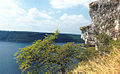 Dniester panorama


.jpg)


See also
[edit]- Romanization of Ukrainian
- List of villages in Khmelnytskyi Oblast
- Subdivisions of Ukraine
- Volhynia
- Podolia
References
[edit]- Inline
- ^ Syvak, Nina; Ponomarenko, Valerii; Khodzinska, Olha; Lakeichuk, Iryna (2011). Veklych, Lesia (ed.). Toponymic Guidelines for Map and Other Editors for International Use (PDF). scientific consultant Iryna Rudenko; reviewed by Nataliia Kizilowa; translated by Olha Khodzinska. Kyiv: DerzhHeoKadastr and Kartographia (United Nations Statistics Division). p. 20. ISBN 978-966-475-839-7. Retrieved 2020-10-06.
- ^ "Zelenskyy appointed new head of Khmelnytskyi Oblast State Administration". Ukrainska Pravda. 3 May 2024. Retrieved 3 May 2024.
- ^ "Голова Хмельницької обласної ради". km-oblrada.gov.ua (in Ukrainian).
- ^ a b Чисельність наявного населення України на 1 січня 2022 [Number of Present Population of Ukraine, as of January 1, 2022] (PDF) (in Ukrainian and English). Kyiv: State Statistics Service of Ukraine. Archived (PDF) from the original on 4 July 2022.
- ^ "Валовии регіональнии продукт".
- ^ "Sub-national HDI - Area Database - Global Data Lab". hdi.globaldatalab.org.
- ^ Cabinet of Ministers of Ukraine – Khmelnytsky Region URL accessed on November 26, 2006
- ^ Ukrcensus.gov.ua – Khmel'nyts'kyi region region Archived 2007-09-30 at the Wayback Machine URL accessed on January 11, 2007
- ^ "Динамика численности этнических украинцев в УССР: на основе итогов Всесоюзных переписей населения 1959 г., 1970 г. и 1979 г." (in Russian). Archived from the original on 2024-06-29. Retrieved 2024-08-03.
- ^ Итоги Всесоюзной переписи населения 1959 года: Украинская ССР, стр. 168—193
- ^ Численность и состав населения СССР: по данным Всесоюзной переписи населения 1979 года. Центральное статистическое управление СССР, 1984
- ^ Чорний С. Національний склад населення України в ХХ сторіччі (2001)
- ^ Итоги Всесоюзной переписи населения 1970 года. Том IV — М., Статистика, 1973
- ^ "Всеукраїнський перепис населення 2001. Розподіл населення за національністю та рідною мовою" (in Ukrainian). Archived from the original on 2019-10-24. Retrieved 2014-08-21.
- ^ "Перепис 1989. Розподіл населення за національністю та рідною мовою (0,1)". Archived from the original on 2020-10-29. Retrieved 2022-03-19.
- ^ "Розподіл населення за національністю та рідною мовою, Хмельницька область". Archived from the original on 2024-04-04. Retrieved 2024-04-04.
- ^ "Про забезпечення функціонування української мови як державної" (in Ukrainian). Archived from the original on 2020-05-02. Retrieved 2020-03-25.
- ^ "«ПОРТРЕТИ РЕГІОНІВ»: ПІДСУМКИ. Зведені дані, порівняльний аналіз між областями" (PDF) (in Ukrainian). Рейтинг. 2018-12-26.
{{cite web}}: CS1 maint: url-status (link) - ^ "Мораторій на використання російськомовного контенту на Хмельниччині: що загрожує порушникам" (in Ukrainian). Суспільне. Archived from the original on 2024-04-10. Retrieved 2024-04-10.
- ^ "У Хмельницькій області діятиме програма із розвитку української мови" (in Ukrainian). Славута.City. 2023-05-12.
{{cite web}}: CS1 maint: url-status (link) - ^ "Перелік завдань і заходів Програми розвитку та функціонування української мови як державної в усіх сферах суспільного життя у Хмельницькій області на 2023—2025 роки" (PDF) (in Ukrainian). Хмельницька обласна військова адміністрація. May 2023.
{{cite web}}: CS1 maint: url-status (link) - ^ "Частка дописів українською мовою в соцмережах зросла до 56 %, — Центр контент-аналізу" (in Ukrainian). 2024-10-28.
{{cite web}}: CS1 maint: url-status (link) - ^ ""Радикальний прогрес". У соцмережах української стало набагато більше, — дослідження" (in Ukrainian). Archived from the original on 2023-12-11. Retrieved 2023-12-11.
- ^ Barbara A. Anderson and Brian D. Silver, "Equality, Efficiency, and Politics in Soviet Bilingual Education Policy, 1934-1980," American Political Science Review 78 (December 1984): 1019-1039.
- ^ «Статистичний щорічник України за 1998 рік» — К., 1999. "Джерело". pics.livejournal.com. Retrieved 2024-12-26.
{{cite web}}: CS1 maint: url-status (link) - ^ "Збірник «Статистичний щорічник України» за 2008 рік" (in Ukrainian). Державна служба статистики України. Archived from the original on 2022-04-08. Retrieved 2024-08-10.
- ^ "Збірник «Статистичний щорічник України» за 2012 рік" (in Ukrainian). Державна служба статистики України. Archived from the original on 2024-08-07. Retrieved 2024-08-10.
- ^ "Збірник «Статистичний щорічник України» за 2018 рік" (PDF) (in Ukrainian). Державна служба статистики України. Archived (PDF) from the original on 2024-08-03. Retrieved 2024-08-10.
- ^ Template:Ref-uk "Загальна середня освіта в Україні у 2021 році". www.ukrstat.gov.ua (in Ukrainian). Archived from the original on 2024-07-07. Retrieved 2024-07-07. — "Сайт Державної служби статистики України". www.ukrstat.gov.ua (in Ukrainian). Archived from the original on 2024-06-04. Retrieved 2024-06-04.
- ^ Template:Ref-uk "Загальна середня освіта в Україні у 2022 році". www.ukrstat.gov.ua (in Ukrainian). Archived from the original on 2024-06-26. Retrieved 2024-06-26. — "Сайт Державної служби статистики України". www.ukrstat.gov.ua (in Ukrainian). Archived from the original on 2024-06-04. Retrieved 2024-06-04.
- ^ "Збірник «Статистичний щорічник України» за 2022 рік" (PDF) (in Ukrainian). Державна служба статистики України. Archived (PDF) from the original on 2024-08-07. Retrieved 2024-08-10.
- ^ 136 students (0.10%) received general secondary education in Polish.
- ^ 256 students (0.26%) received general secondary education in Polish.
- ^ "Загальна середня освіта в Україні у 2023 році". www.ukrstat.gov.ua (in Ukrainian). Archived from the original on 2024-06-01. Retrieved 2024-06-01. — "Сайт Державної служби статистики України". www.ukrstat.gov.ua (in Ukrainian). Archived from the original on 2024-06-04. Retrieved 2024-06-04.
- Information Card of the Region – Official site of the Cabinet of Ministers of Ukraine
External links
[edit]- adm-km.gov.ua – Official website of Khmelnytska oblast Administration (in Ukrainian)
- Khmelnytsky – Site of Khmelnytskyi (in Ukrainian and Russian)
| International | |
|---|---|
| National | |
| Geographic | |